geography
 suli1993
 nm_physical_geography.pdf
NEW MEXICO Geography 325V
Dr. Wright
New Mexico Learning Objectives
Gain a working knowledge of the physical,
economic, cultural, and historical geography of
New Mexico
What makes NM so different from other Western states?
Specific learning objectives given for each section
Apply this knowledge to analyze a major question
“Why is New Mexico so poor and what should we do
about it?
A 10-page research paper is assigned (see syllabus)
NM and Poverty
Percentage of children living in poverty Why does NM always have such a high rate?
Applied Geography
Analyzing diverse facts and factors to help
solve a problem faced by society
As we go through the New Mexico section
your goal is both learn factual content and
use that information to address our big
question
Why is New Mexico so poor and what should
we do about it?
New Mexico Geographic Traits
What are the key traits of New Mexico?
What makes NM different than Arizona,
Utah, Colorado, Montana…?
Let’s talk about this
New Mexico
Physical Geography
What the land is like
The physical stage for human events
What opportunities and limitations does the
natural environment create?
Learning Objectives
Physiographic Provinces of New Mexico
Be able to draw boundaries and know the landforms
Patterns of aridity in NM
Orographic Precipitation and “Sky Islands”
Arizona Monsoon – why does it happen?
The Spring Wind of the Southwest (name for it?)
Chihuahuan Desert
Be able to draw the boundary and know ecological traits
Terrain Analog
Be able to define and give examples
Landforms of the North America
Fenneman Version of
U.S. Physiographic Provinces Use this one for studying
New Mexico – Physiography
New Mexico’s
Physiographic Provinces
• Basin and Range: mountains and broad basins (Albuquerque, Las Cruces)
– Gila Mountains: Datil-Mogollon volcanics
– Rio Grande Rift: a structural valley running north-south through New Mexico
• Colorado Plateau: sedimentary rocks and deep canyons (Navajo Nation)
• Southern Rockies: Sangre de Cristo and Jemez Mountains (Santa Fe, Taos)
• Great Plains: a ramp of flat-lying rocks (Clovis, Carlsbad, Tucumcari, Artesia, Roswell)
Sandias and Albuquerque Classic Basin and Range landscape
Sandia Mountains
Albuquerque: a Basin city
Las Cruces: a Basin city
Las Cruces and Organ Mountains
Sugarloaf Peak
Sugarloaf Peak
Rio de Janeiro, Brazil
Sacramento Mountains Sierra Blanca – 12,003’
Pyramid Mountains South of Lordsburg
Animas Mountains In New Mexico’s “Bootheel”
Diamond A Ranch 500 square miles in the Bootheel
Malpai Borderlands
Classic Basin and Range
Jaguars in Peloncillo Mountains NM Bootheel
Mogollon/Gila
Volcanic Mountains and Broad Valleys
Mogollon-Datil Volcanic Field Gila Mountains Region
Gila Mountains
Gila Wilderness
Created in 1924
Aldo Leopold Helped created Gila Wilderness, 1924
Leopold’s “Land Ethic”
• “A thing is right when it tends to
preserve the integrity, stability, and
beauty of the biotic community; it is
wrong when it tends otherwise”
Wilderness Act of 1964
• President Johnson signs the law
Increase in Wilderness Areas
Gila Cliff Dwellings Volcanic Rock
Very Large Array (VLA) telescope
Plains of San Agustin
Montosa Ranch West of Magdalena
Volcanic Activity in Southern
NM
Border of Gila Volcanics
and Colorado Plateau
Rio Grande Rift Valley Rift = a structural tear in Earth’s crust
Rio Grande Rift
Rio Grande Rift Crust stretches and lava pours out
Lava Flows in Rio Grande Rift Carrizozo, NM
Lava flows
White
Sands
Rio Grande Gorge, Taos
Rio Grande Rift, Taos
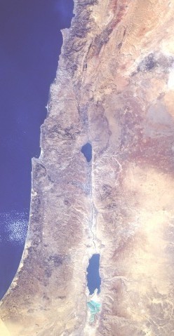
Other “rift valleys”
Jordan River into Africa
Rift Valley in Jordan
Dead Sea
“Great Rift Valley” Africa
Mount Kilimanjaro volcano
Picacho Peak and Rio Grande
Las Cruces
Colorado Plateau
Colorado Plateau
Goosenecks of the San Juan River
Navajo Reservation
Window Rock – Navajo Nation
Shiprock – Navajo Nation
A volcanic “neck”
Great Plains Flat lying sediments, rivers flow east
Great Plains Province
East-sloping ramp of sediments
The Great Plains in NM
Llano Estacado
“The Staked Plains”
The Great Plains
Ranch near Raton
Dust Bowl – 1930s
Ogallala Aquifer “Fossil Groundwater” being pumped for irrigation
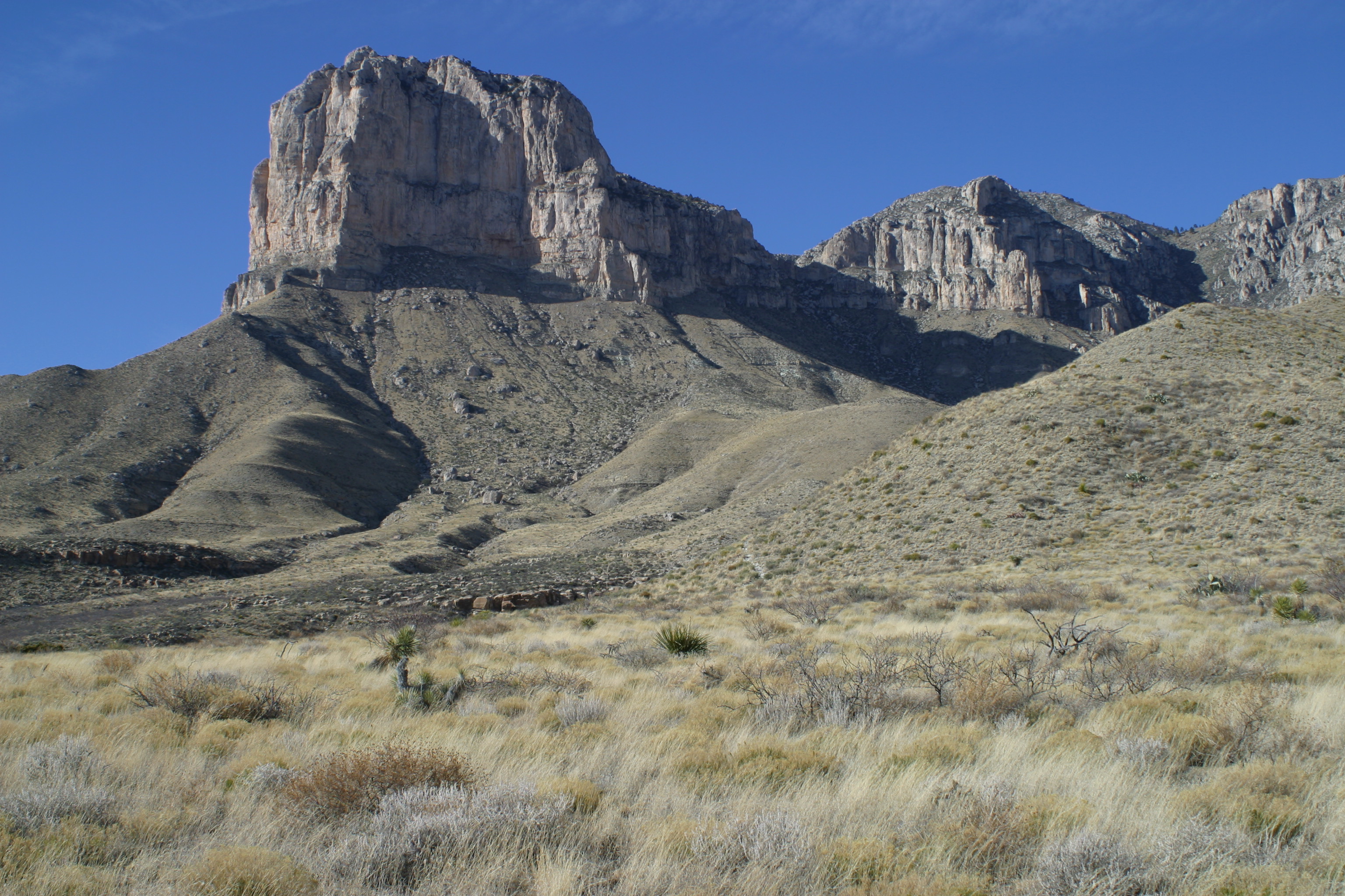
Guadalupe Mountains At edge of Great Plains
Southern Rocky Mountains (SRM)
Rockies are smaller than they seem
New Mexico Rockies
• Sangre de Cristo Mountains
• Jemez Mountains
• Southern San Juan Mountains
Southern Rocky Mountains:
Sangre de Cristo Range
Wheeler Peak
Highest peak in NM: 13,141’
Truchas Peak
Santa Fe Baldy
Blue Lake Sacred part of Taos Pueblo Lands
Sangre de Cristo Mountains, Taos
Jemez Mountains Valles Volcanic Caldera
Valles Caldera New Mexico’s Yellowstone
Valles Caldera National Preserve
Elk in Valles Caldera
Redondo Peak Sacred to Jemez Pueblo
Watersheds: Define the Continental Divide
Watersheds of New Mexico
Rio Grande Headwaters San Juan Mountains, Colorado
Rio Grande Taos Box Canyon
Rio Grande south of Taos
Cochiti Lake (a reservoir)
Rio Grande
Albuquerque
Elephant Butte Reservoir Water source for Mesilla Valley farms
Rio Grande
Southern New Mexico
Pecos River Headwaters in Sangre de Cristo Range
Bosque Redondo
Navajo Internment
Pecos River Christmas in Carlsbad
Pecos River in Texas
San Juan River
“Goosenecks of the San Juan”
Aerial View of the Goosenecks River meanders incised in solid rock
Gila River
“The Catwalk”
Gila River
Gila River often dries up in Arizona
Canadian River Flowing east, into the Great Plains
New Mexico
is arid
• Except in
the
mountains
Orographic Precipitation Why mountains are wetter
Orographic Precipitation in Cascades
Windward wet side and Leeward dry side
Mount Taylor, NM “Sky Island” of wet environments
Compare
landforms
and
precipitation
But why is so much of
New Mexico arid?
• Hadley Cell
– Sinking air is common at about 30 degrees
North and South latitude
– Sinking air creates high pressure and
warming air = little rain
– Air needs to be lifted and cooled to create rain
• Orographic Precipitation and Rain
Shadow effect
– Much of New Mexico is in the “rain shadow” of
high mountain ranges: little rain falls
Factor #1: Hadley Cell Sinking air at 30 degrees latitude
• Sinking air heats = less rainfall = aridity
Las Cruces Arid Climate
• 8” of rain per year
• “Arizona Monsoon” – July, August, September
– 5-6 inches of rain fall during summer months
– Largest Monsoon in world history was in India,
1861 – 1,080” = 90 feet of rain!
• 350 sunny days per year in Las Cruces
“Arizona Monsoon” Summer Rain dominant in NM
What causes a “Monsoon?”
Intense summer heat causes air to rise across NM During summer this force is stronger than the sinking
air created by the Hadley Cell.
Rising air creates “Low Pressure.”
Moist air drawn in from Pacific Ocean, Gulf of Mexico
Moist air arrives and is lifted by heating in NM.
Thunderstorms and heavy rain created.
In Fall, temperatures drop and the Monsoon ends.
This same force operates in India and other classic
Monsoonal climates
New Mexico’s
Strong Spring Winds
• What causes it?
• Effects?
• Dr. Wright has formally proposed an
official name for this wind.
Toponomy Naming places
• Spatial folklore
• Cultural narratives
• Psychological adaptation
• Social conflicts
• Historical geography
• Place formation
• Contested land tenure
• Racism
• Humor
“Black Mesa”
San Ildefonso Pueblo, NM
• Tsahveeyo
– Pueblo narrative: evil giant who ate
children
• Gigantes
– Spanish narrative: co-opting a Native one
• Black Mesa
– Anglo narrative: captures the look, but no
more
Naming the Wind
• Santa Ana
– Hot dry katabatic winds in California
• Joan Didion
• Raymond Chandler
• Steely Dan
• Santana
Naming the Wind
• Euros
– Greek name for easterlies
• Aeolius
– Greek motherland of storms
• Mistral
– Cold northerlies in France
Naming the Wind
• Middle East/North Africa – Hot dry summer winds
• Sirocco
• Khamsin
• Ghibli
• Haboob (Egypt and Arizona)
• Harmattan
• Nashi
• Sharan
• Sharki
• Sharav
The Southwest’s Spring Wind
• March begins this “extra season” – Southwest is the dustiest region in North America
– Spring windstorms help define the region geographically
• 1,100 “notable” dust storms between 1932 and 2015 – Visibility less than 10 Km for 2 hours or more
• Cause: – eastward traveling cold fronts
– bends in the jet stream followed by strong high altitude winds that turn southward
– fierce when the spiral is centered in northern NM, the “Albuquerque Low” sucks air in from Mexico
Typical 500 hPa geopotential height (gpm/10) anomaly showing
steepening pressure gradient and resulting SW winds around an
“Albuquerque Low” pressure center
Choosing a Name
• The Southwest is strongly tri-cultural
– Native American
– Hispanic
– Anglo
• All have various names for wind
• Yet, no name for the Spring wind
Native American Names
• 21 Pueblo Nations in the Southwest – Beliefs that wind brings disease, miscarriage,
ethical lessons, a pantheon of spirits
• Diné (Navajo) – Male and female winds, sacred or profane,
harmful or problem-solving, Dark Wind, Blue Wind
• Apache Nations – Complex ethno-linguistic meaning of place
names
Spanish Names
• El Diablo in California
• Literature review and 26 years of asking people in the region reveals that there is no shared name in Spanish for the spring wind in the Southwest
• Dr. Patricia McGregor-Mendoza, a linguist at NMSU consulted
Anglo Names
• Only Dust Bowl names have been widely used
– Dusters
– Black Blizzards
– Black Rollers
• None of these names are tied to the Spring winds of the Southwest
El Cabrón
• A range of meanings in Mexican,
Chicano, Hispano, Tejano slang
– Old Goat
– Bastard
– S.O.B.
• El Cabrón is a crude choice, but let me
explain
Rationale
• No Native American name emerged or
felt appropriate
– These cultures have been abused and
commodified for centuries
• Choosing or making up a name in
English would send a message of
marginalization to the “minorities” of
the Southwest
Why a Spanish Name?
• Spanish links Native Americans,
Hispanics, and Anglos in diverse ways
– Indians used Spanish as a lingua franca
during the 1680 Pueblo Revolt
– Many Spanish speaking Indians today
– Indians with Spanish surnames
– Anglos born to the region acquire some
Spanish
– In New Mexico, Hispanics are the majority
Etymology
• Cabra
– Spanish for goat
• Spain
– Descuernacabras
• “wind that de-horns goats”
– Matacabras
• “wind that kills goats”
The Deeper Meaning
• The spring wind frustrates and angers people – It destroys plans, makes us sick, damages
crops and property, causes auto accidents, erodes soils, and generally wreaks havoc
• Puns, wordplay, double meanings, and making light of what is heavy are important coping mechanism of all cultures facing the challenges of land and life in the Southwest – El Dia de los Muertos: confronting death
– Sacred Clowns in somber Pueblo ceremonies
The Role for Playfulness
• The Southwest is a place of intense conflicts over land tenure
– Pueblo, Athabaskan, Spanish, Mexican, American
– U.S.-Mexico Border immigration and trade conflicts
• A place of cumulative occupance
• The pain of these cultural and geo-political collisions still burns across the region
Proposed region of El Cabrón
El Cabrón as Adaptation
• Curse and smile at the dusty wind
• Stubborn pride in a rite of passage
• Wise humor about surviving tough times
• A reminder – perhaps summer rains will bring relief on the other side – all troubles pass – Impermanence
An Arid Message of Mortality
• “Earth to earth, ashes to ashes, dust to dust”
Four Deserts of North America
Chihuahuan Desert
• Summer rain dominant
– “Arizona Monsoon”
• Winter storm fronts provide 35% of
precipitation
• Soaptree Yucca and grasslands
– Much is now creosote bush/mesquite
scrub
• Named for Mexican State of Chihuahua
Chihuahuan Desert
Chihuahuan Desert Grassland/scrub mix
Soaptree Yucca Signature plant of the Chihuahuan Desert
Oryx
from
Africa
at WSMR
White Sands National Monument World’s largest gypsum sand dune field (Erg)
Otero Mesa Grasslands
Pronghorn
Antelope
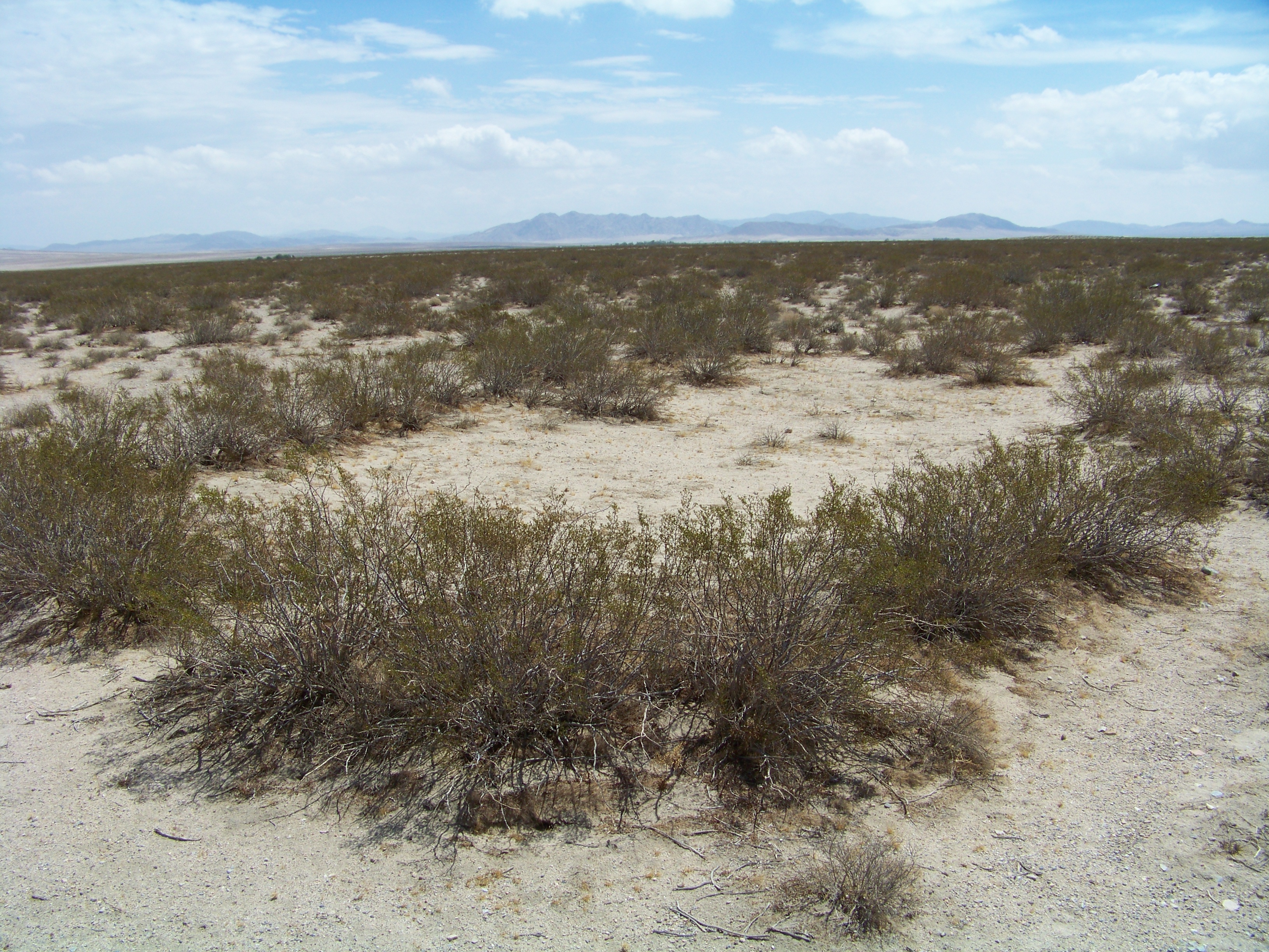
Creosote bush Grows in all U.S. deserts but the Great Basin
“King Clone” 11,700 year old creosote bush ring
in Mojave Desert in California
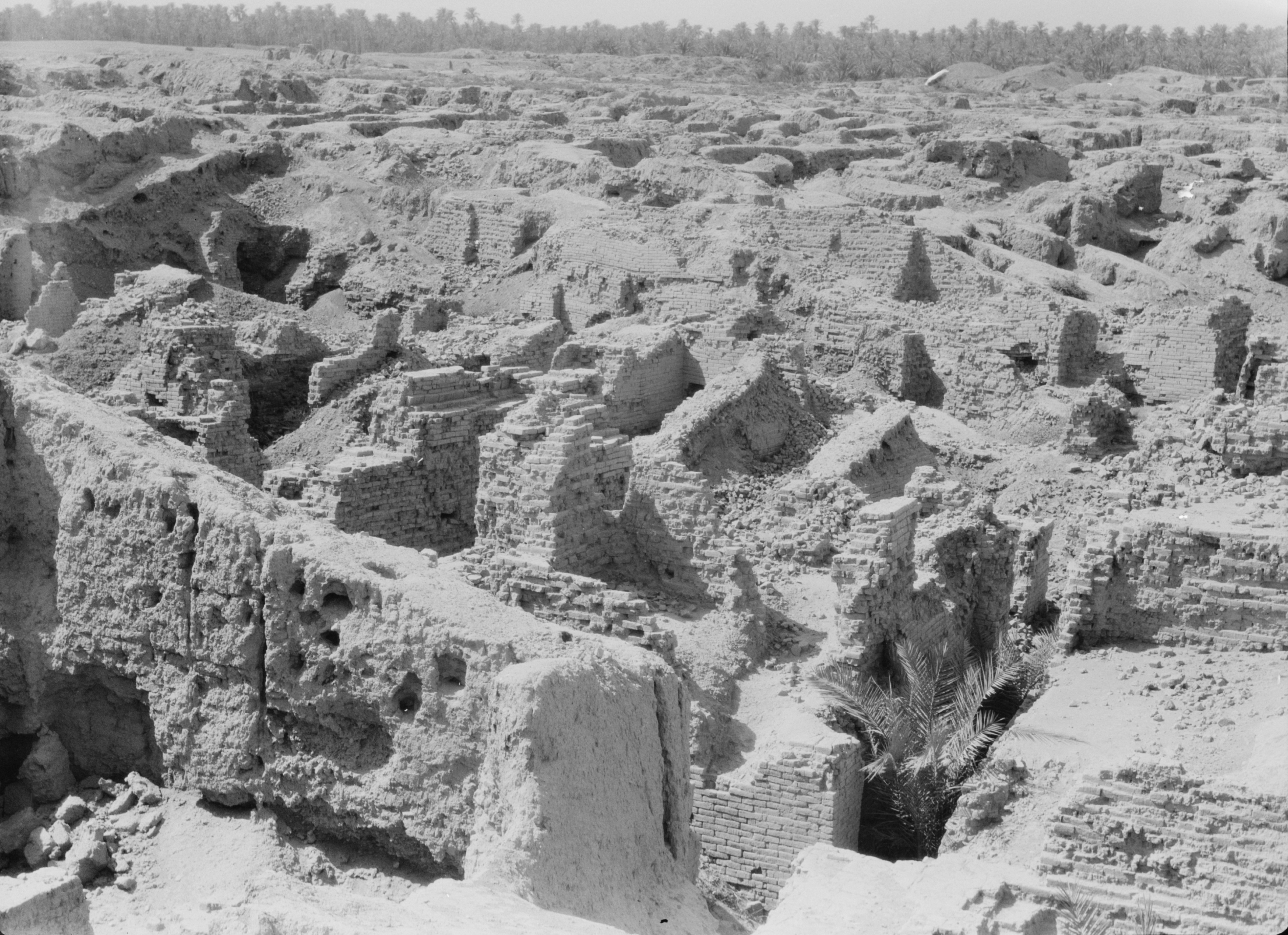
New Mexico A “Terrain Analog”
• “Terrain Analog” means a landscape
that is very similar to other landscapes
in the world
• New Mexico contains terrain analogs
for arid environments in the Middle
East and North Africa
Which landscapes are in NM
and which are not?
Iraq Plane Buried in the Desert
New Mexico Desert Analog
Afghanistan New Mexico
Aztec Ruins Monument, NM
Flashflood in Arroyo
Learning Objectives
Physiographic Provinces of New Mexico
Be able to draw boundaries and know the landforms
Patterns of aridity in NM
Orographic Precipitation and “Sky Islands”
Arizona Monsoon – why does it happen?
The Spring Wind of the Southwest (name for it?)
Chihuahuan Desert
Be able to draw the boundary and know ecological traits
Terrain Analog
Be able to define and give examples